Introduction
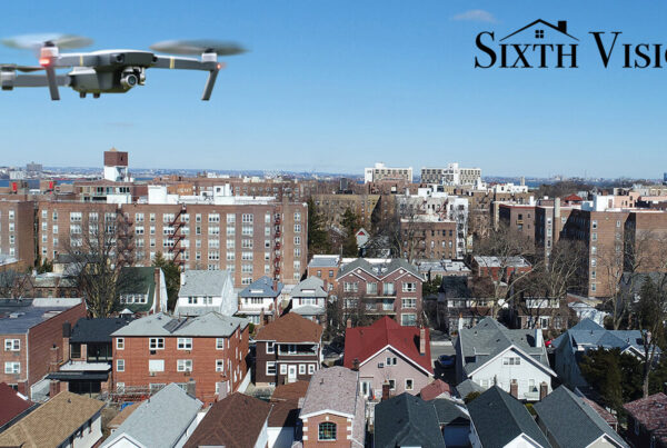
Aerial photography Melbourne has become a priceless resource for many enterprises in the modern digital era. Aerial photography is being used by companies in a range of sectors, such as tourism, agriculture, real estate, and construction, to enhance operations and gain a competitive edge. This essay will examine the sectors that profit greatly from aerial photography, with Melbourne, a vibrant Australian metropolis, as its focal point.
Real Estate: Captivating Visuals for Property Marketing
The industrial photography melbourne has recognised the power of Aerial photography Melbourne in capturing captivating visuals for property marketing. With the use of drones and professional photographers, real estate agents can showcase commercial properties, residential developments, and expansive land areas in a unique and compelling way.
In Melbourne, aerial photography has revolutionised the way properties are presented to potential buyers and investors. High-quality aerial images and videos allow prospective clients to visualise the property’s location, proximity to amenities, and overall layout. This bird’s eye view offers a comprehensive understanding of the property, which is particularly valuable in a fast-paced real estate market like Melbourne.
Construction: Monitoring Projects from Above
The construction industrial photography melbourne heavily relies on aerial photography to monitor projects and enhance project management. By utilising drone photography in Melbourne, construction companies can capture high-resolution images and videos of their construction sites, providing a detailed overview of the progress and identifying any potential issues.
Aerial photography offers construction professionals a unique perspective that was previously difficult to obtain. With regular aerial surveys, project managers can track construction progress, assess site logistics, and identify areas that require attention. This data-driven approach enables timely decision-making, ensuring that projects stay on schedule and within budget.
Tourism and Hospitality: Showcasing Melbourne’s Attractions
Melbourne’s vibrant tourism and hospitality industry greatly benefits from aerial photography in showcasing the city’s attractions. From iconic landmarks to scenic landscapes, aerial photography captures Melbourne’s beauty from a perspective that is both captivating and immersive.
Aerial images and films of Melbourne’s well-known monuments, like Federation Square and the Yarra River, arouse amasement in tourists and inspire them to explore the city. Aerial photography can be used by hotels and resorts to highlight their amenities, location near attractions, and magnificent vistas, drawing in more guests and boosting their internet presence.
Agriculture: Precision Farming with Aerial Photography
Promoting sustainable farming practices and improving crop management in the agricultural sector requires aerial photography. Using drone technology, farmers in the Melbourne area may capture aerial photographs of their fields to monitor crop health, assess soil quality, and search for pest or disease indications.
real estate photography melbourne provides farmers with a comprehensive view of their land, allowing them to identify areas that require specific interventions. By analysing the data captured through aerial surveys, farmers can create precision farming maps that guide the application of fertilisers, pesticides, and irrigation. This targeted approach minimises resource wastage and maximises crop yield, ultimately promoting sustainable agriculture practices.
Environmental Conservation: Monitoring Melbourne’s Natural Resources
real estate photography melbourne is a valuable tool in environmental conservation efforts in and around Melbourne. Environmental organisations can monitor natural resources, evaluate the condition of ecosystems, and spot areas that need conservation measures by conducting aerial surveys.
In Melbourne, aerial photography is particularly useful in monitoring the city’s parks, wetlands, and forests. These images provide valuable insights into biodiversity, habitat connectivity, and overall ecosystem health. By understanding the changes and challenges faced by Melbourne’s natural resources, environmental organisations can take proactive steps to protect and preserve these valuable assets.
Event Planning: Capturing Memories from Above
real estate photography melbourne provides a distinctive viewpoint for capturing priceless moments when it comes to planning large-scale events. Aerial images offer a panoramic view, showcasing the grandeur and excitement of the occasion whether it be a music festival, sporting event, or wedding. Drones can be expertly piloted by aerial photographers to take magnificent pictures of the event, producing a permanent visual record that captures the mood, size, and excitement of the crowd.
Urban Planning: Shaping Cities of the Future
Urban planners and city officials leverage real estate aerial photography to shape the development and expansion of cities. By analsing aerial images, they gain valuable insights into infrastructure needs, transportation routes, and land use patterns. Aerial photography helps identify potential areas for development, assess population density, and plan for urban expansion. By visualising cities from above, urban planners can make informed decisions that promote sustainable growth and enhance quality of life for residents.
FAQs (Frequently Asked Questions)
Q1: What is real estate aerial photography?
Ans: real estate aerial photography captures images from above, providing a bird’s eye view of landscapes, properties, and infrastructure.
Q2: Why is aerial photos melbourne important for real estate?
Ans: aerial photos melbourne showcases properties with captivating visuals, attracting potential buyers and highlighting unique features.
Q3: How does aerial photography benefit the construction industry?
Ans: Aerial photography monitors construction progress, identifies issues, and enables informed decision-making for improved project management.
Q4: Can aerial photography be used for tourism promotion?
Ans: Yes, aerial photography captures stunning views of tourist destinations, enticing travelers to visit and explore.
Q5: How does aerial photography aid in agriculture?
Ans: Aerial photography monitors crop health, detects pests and helps optimise resource allocation for improved agricultural practices.
Conclusion
Aerial photography Melbourne has transformed various industrial photography melbourne, offering unique perspectives and valuable insights. Businesses and organisations across a variety of sectors, including real estate and construction, tourism, agriculture, and environmental conservation, are employing aerial photography to enhance operations, make data-driven choices, and engage target audiences. The future of these businesses in Melbourne and around the world will undoubtedly be more heavily influenced by aerial photography as technology develops.