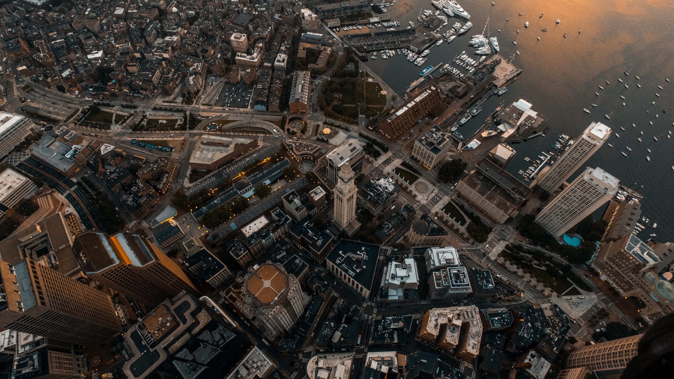
What is Aerial & Drone Photography?
Aerial photography is the art of capturing images from above. Traditionally, this was done by taking pictures from planes, helicopters, or hot air balloons. However, with the rise of unmanned aerial vehicles (UAVs), commonly referred to as drones,aerial photography has become more accessible and affordable.
Drones are small, remote-controlled aircraft that can be equipped with high-quality cameras, enabling photographers to capture stunning aerial images and videos from unique perspectives. Aerial and drone photography is commonly used in industries such as real estate, construction, agriculture, and tourism.
The Price Elements of Your Drone Services Job
The cost of drone photography services varies depending on several factors, including the type of drone photography service you require, the complexity of the job, and the pricing model used by the service provider. Some of the most common types of drone photography services include aerial photography, videography, mapping, surveying, and inspections.
When budgeting for your drone photography services job, it’s essential to consider the following cost factors:
- Equipment costs: drones, cameras, and accessories
- Labor costs: pilot fees, operator fees, and editing fees
- Insurance and liability coverage
- Travel expenses, if applicable
Drone photography cost providers typically use one of three pricing models: flat fee, hourly rate, or per image/video. Flat fees are often used for standard drone photography cost services, such as real estate photography, while hourly rates are more common for complex jobs like construction site inspections.
How Much Does Drone Photography Cost?
The average cost of drone photography in Melbourne ranges from $200 to $500 per hour, depending on the complexity of the job and the pricing model used. Some drone photography costs a flat fee per project or per image/video, while others charge an hourly rate.
To estimate the cost of your drone photography project contact us today
Drone photography Surveying Service in Melbourne.
If you’re looking to hire a drone photography surveying service in Melbourne , there are a few things to consider. Firstly, ensure that the company you are hiring is compliant with the Civil Aviation Safety Authority (CASA) regulations for drone operation. This means that the company must have an operator’s certificate and insurance coverage.
Secondly, consider the specific requirements of your project. Different drone photography surveying services may offer different capabilities, such as high-resolution imaging or topographical mapping. Make sure that the company you choose can meet your specific needs.
Finally, be sure to obtain a clear understanding of the costs involved, including the drone photography cost, any additional equipment or data processing costs, and any other fees that may apply.
Do I Need Permission to Use a Drone at Any Location?
In Melbourne , drone usage is regulated by the Civil Aviation Safety Authority (CASA). Depending on the specifics of your operation, you may need to obtain permission from CASA before flying a drone.
For most recreational drone use, no permission is required. However, if you are flying a drone for commercial purposes or flying in restricted airspace, you will need to apply for a Remote Pilot Licence (RePL) from CASA. Additionally, if you are flying in certain sensitive areas such as near airports or national parks, you may also need to obtain permission from relevant authorities.
It’s important to be aware of the regulations surrounding drone usage in Melbourne and to follow them to ensure safe and responsible operation.