Introduction
Aerial photography is an enthralling field that allows us to generate stunning images while also giving us with a unique perspective from above. It comprises photographing or filming the Earth’s surface using aircraft, drones, or satellites. We will look at how aerial photography works, the equipment required, and the various applications offered in this post.
Aerial photography is the art and science of photographing the Earth’s surface from a high vantage point. It gives us vital visual information that is difficult to gather with traditional photography. By soaring to the air, photographers can capture spectacular views, cityscapes, and even accurate close-ups of specific spots of interest.
History of Aerial Photography
Aerial photography has a long history, beginning in 1858 when French photographer Gaspard-Félix Tournachon, also known as Nadar, took the first aerial picture from a hot air balloon. Since then, the industry has seen a transformation thanks to technological advancements and the introduction of new technology.
Types of Aerial Photography
There are various types of aerial photography techniques employed today. Let’s explore the three main categories:
- Traditional Aerial Photography: Traditional aerial photography employs manned aircraft, such as aeroplanes and helicopters, to collect photos from above. These aircraft are outfitted with high-resolution cameras mounted on specialist mounts or gyro-stabilised systems as standard. Professional photographers, surveyors, and mapping organisations regularly use this technology to acquire large-scale photos.
- Drone Aerial Photography: Aerial photography has grown more accessible and adaptable since the introduction of unmanned aerial vehicles (UAVs), sometimes known as drones. Drones with high-quality cameras may capture images and films from a variety of heights and perspectives. They provide flexibility, maneuverability, and the capacity to reach previously inaccessible locations.
- Satellite Aerial Photography: Satellite aerial photography employs imaging satellites that circle the Earth taking images of the planet’s surface. These satellites gather data from all over the world as they orbit the Earth. Satellite imagery is frequently employed to examine weather patterns, identify shifts in land use, and provide vital information for scientific investigations.
Aerial Photography Equipment
To capture stunning aerial photographs, photographers rely on a range of specialised equipment. Let’s take a look at the essential tools used in aerial photography:
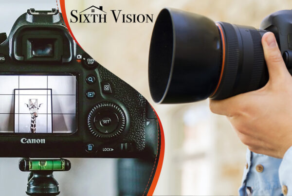
- Cameras: Aerial photography relies on high-quality cameras. They must be able to capture high-resolution photographs, have manual controls for altering settings, and have image stabilisation functions to compensate for vibrations and motions while in flight.
- Aircraft and Drones: Traditional aerial photography employs manned aircraft such as aeroplanes and helicopters. They can accommodate a lot of photographic equipment and are stable and long-range. Drones, on the other hand, are small, unmanned aircraft that have a wide range of applications. They can be controlled remotely by the user and have cameras.
- GPS Systems: GPS (Global Positioning System) technology plays a crucial role in aerial photography. It enables precise positioning of the aircraft or drone and helps photographers navigate to specific locations. GPS also aids in geotagging images, allowing for accurate mapping and identification of the photographed areas.
- Image Stabilisation: Aerial photography involves capturing images from a moving platform, which can introduce vibrations and movements that impact image quality. Image stabilisation systems, such as gyroscopes and gimbals, help reduce these unwanted effects and ensure sharp and clear photographs.
How Aerial Photography Works
The process of aerial photography can be broken down into several key steps:
- Planning the Flight: Before a photography session, careful planning is essential. Determine the desired height, flying path, and camera settings. To ensure a safe and effective trip, weather conditions and airspace regulations must also be considered.
- Capturing the Images: Once the aircraft or drone is airborne, the photographer focuses on capturing the desired images. To take the greatest pictures possible, they manipulate the camera’s settings, change the composition, and schedule the shots. Several photos may be taken from various angles and heights, depending on the shoot’s objectives.
- Image Processing: Following the acquisition of the images, they are treated to post-processing. This includes transferring the files to a computer and structuring them for future editing and analysis. To improve the aesthetic impact of the photographs, the photographer may utilise software tools to change exposure, colours, and other features.
- Image Enhancement: Additional picture enhancement techniques are used in some circumstances to improve the quality and visual appeal of the photographs. Adjusting brightness and contrast, deleting undesired items or imperfections, and applying filters to achieve certain effects are all examples of this.
Applications of Aerial Photography
Aerial photography finds applications in various fields. Here are a few examples:
- Surveying and Mapping: Aerial photography is extensively used in land surveying and mapping. It allows for the creation of accurate topographic maps, identification of property boundaries, and assessment of terrain features. Surveyors can use aerial images to gather data for construction projects, urban planning, and environmental assessments.
- Real Estate: In the real estate industry, aerial photography provides a unique perspective for showcasing properties. High-quality aerial images can capture the surrounding landscape, highlight property features, and give potential buyers a comprehensive view of the property and its surroundings
- Environmental Monitoring: Aerial photography plays a crucial role in monitoring and assessing environmental changes. It helps track deforestation, analyse land use patterns, and identify potential areas of ecological concern. Aerial imagery also aids in studying wildlife habitats and monitoring the impact of natural disasters.
- Tourism and Travel: Aerial photographs are widely used to promote tourist destinations and showcase scenic landscapes. They provide a captivating visual representation of popular tourist spots, enabling travelers to visualise and plan their trips effectively.
Conclusion
The way we perceive and record the world around us has altered as a result of aerial photography. Using aircraft, drones, and satellites, photographers may discover new perspectives, unearth unseen details, and create stunning images. The possibilities are endless because to advances in technology and easier access to aerial photography equipment. Whether done for business or pleasure, aerial photography gives us a fresh perspective on the world.